Find your dock or ramp elevation
You do not need a surveyor. A tape measure, a calm day and today's lake reading give you the elevation of any point on your dock or ramp to within a few inches.
The tape-measure method
- Pick the point that matters. For a boat ramp, it is the bottom end of the concrete. For a fixed dock, the depth your boat needs under it. For a floating dock, the lowest point where it would ground or the end of its walkway's travel.
- Measure from the water surface on a calm day. If the point is under water, measure how far below the surface it is. If it is above the water, measure how far above. Note the date and time.
- Look up the lake level for that moment on your lake's page. Corps lakes update every 15 to 60 minutes; Reclamation lakes once a day.
- Add or subtract. Elevation of the point = lake level + height above the water, or lake level − depth below it.
Example. At 9 a.m. the lake reads 655.4 ft. The end of the ramp is 3 ft 6 in under water. The end of the ramp is at 655.4 − 3.5 = 651.9 ft. When the lake falls below about 652 ft, the end of the ramp is in the air. If your boat needs 2 ft of water off the ramp, the practical limit is about 654 ft.
Because you measured against the lake itself, the result is on the same datum as the lake readings, and you avoid the datum mix-ups described in how to read a lake elevation.
Then use the dock check
Every lake page with enough history has a dock check. Type the elevation you just found and it shows, month by month, how often over the last ten years the lake was at or above it. A ramp that has water under it 95% of days in June but 40% in November tells you when to plan the last trip of the season and when to pull the boat out.
Find your lake from the list of all lakes or by state, then press “Check your dock” near the top of the page.
Other places to find an elevation
- The lake's project office. Corps and Reclamation offices list public ramp elevations and announce closures when the water falls below a ramp.
- Your shoreline permit or plat. Lots on federal lakes often show a contour line, such as the property or flowage-easement line, in feet. Check which datum it uses before comparing it with lake readings.
- A survey. A licensed surveyor can set an elevation for your dock or seawall. Ask for the same datum the lake reports on.
When the water is low
- Hazards rise. Sandbars, stumps, rock piles and old roadbeds that are normally deep can be just under the surface. Navigation markers placed for normal levels may no longer mark the shallow edge. Run slower in unfamiliar water.
- Ramps close. When the water drops off the end of a ramp, the agency closes it; trailers can drop off the concrete edge. Check the lake's project page before driving out.
- Floating docks need slack. Walk out on anchor chains or cables as the lake falls so the dock does not hang, and move it to deeper water if the lake keeps dropping.
- Water intakes and lifts. Shore pumps and boat lifts set for normal water can end up in mud.
These lakes are furthest below their normal for today's date:
| Lake | Level (ft) | Vs full pool |
|---|---|---|
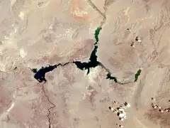 Lake Mead NV/AZ | 1,039.21 | 189.8 ft below |
 Blue Mesa Reservoir CO | 7,418.22 | 19.6% full |
 Pineview Reservoir UT | 4,832.90 | 2.7% full |
 Jackson Lake WY | 6,734.62 | 33.4 ft below |
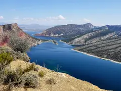 Flaming Gorge Reservoir WY/UT | 6,004.48 | 35.5 ft below |
| Kirwin Reservoir KS | 1,704.08 | 13.2% full |
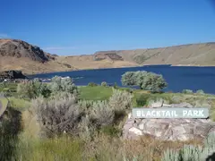 Ririe Reservoir ID | 5,064.87 | 41.1 ft below |
| Webster Reservoir KS | 1,865.53 | 9.0% full |
A level is not a forecast
The dock check shows what happened in past years, not what will happen this year. Dam operators can change releases within days, and dry or wet weather can move a lake out of its usual range. For planned drawdowns or emergency changes, the agency's own announcements are the authority.
More lake level guides
- What “full pool” means: Full pool, flood pool and dead pool: the layers of a reservoir, and why a lake above full pool is not a full lake.
- Why lakes are lowered in winter: Why many Corps lakes drop several feet every fall on purpose, and which ones are drawn down the most.
- How to read a lake elevation: What a reading like 1,071.3 ft means, why lakes cannot be compared by elevation, and what NGVD29 and NAVD88 are.
- Who decides how full a lake is: How the Corps of Engineers and Reclamation decide how much water to hold or release, and why a lake can fall after rain.
Lakes people check most